|

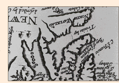
That Cupers Cove and Cupids are one and the same has been known for some time. On 6 October, 1610 John Guy wrote that Cupers Cove was in a harbour adjoining Salmon Cove, as Bay de Grave was then known, and roughly nine miles north of Colliers. Other documents mention a lake "two miles in length and the sixt part of a mile broad" and a little pond at the bottom of the harbour exactly like present day Cupids. John Mason's map of Newfoundland, first published in 1625, shows 'Cuperts Cove' on the south side of Bay de Grave where Cupids stands today. Indeed, the name 'Cupids' was in use at quite an early date. In a letter written in April 1613, Bartholomew Pearson refers to the colony as "Cupids Kove" and in 1624, Sir William Alexander, states that "The first houses for habitation [in Newfoundland] were built in Cupids Coue within the Bay of Conception..."
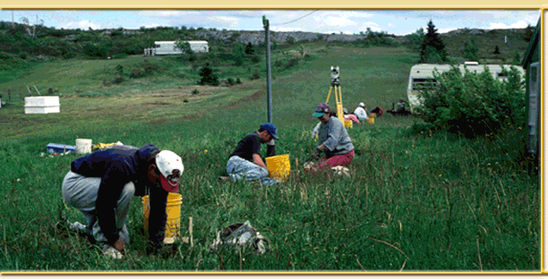
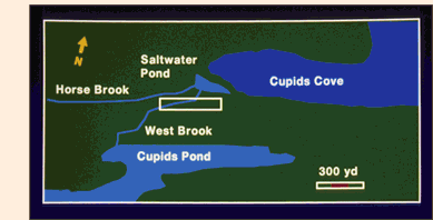
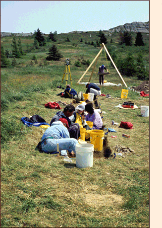
Our survey began on June 7, 1995 but before we arrived in Cupids we had already consulted the letters and other documents left behind by the people who settled Cupers Cove and found three clues that helped narrow down the location of the site. In his letter of 16 May 1611, John Guy tells us that the lake at the bottom of Cupids harbour was "within twelue score of our habitation". Since a score is a distance of twenty paces, the plantation must have stood roughly 240 paces from the lake. Both Guy and another colonist, Henry Crout, mention that the plantation was near a brook. Guys says that he went to the brook every morning to wash and Crout mentions that in the spring of 1613, after a hard winter, they were catching trout in that brook. Finally, Crout mentions that the plantation was on the landward side of the little pond at the bottom of Cupids harbour. Taken together, these three clues defined an area of about 1/2 km at the bottom of Cupids harbour somewhere within which the colony must once have stood.
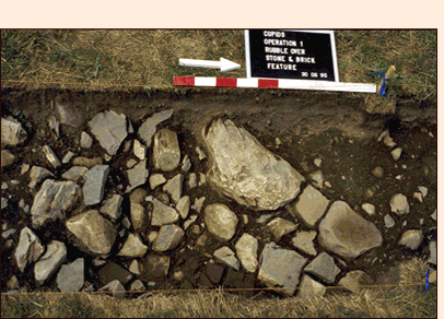
We began testing in the western end of this area and worked our way east but it was not long before we realized that what a number of local people had told us was true - much of the land within our survey area was man-made and had been built up over wet ground so that people could construct their houses. This meant that most of our survey area would have been total unsuitable for settlement when Guy's party arrived. However, there was one exception. At the eastern end was a dry, level terrace that rose about four metres above the low ground to the west.
|
|